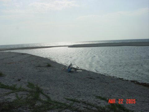
1. Get a ride (car,
tricycle, bike, carabao cart, etc) or walk from Municipal bldg roughly 2.5
km to point #2 in Karampoan.2. Get off the road
here and start trekking towards Lubong and Lubong Uneg to point #3. Probably
take 1/2 hr.
3. This is bottom of Anghalo Falls. There is an
approximately 60 ft vertical climb to the top of the falls. Climb(literally)
up the cliff till you reach the top.
4. A little ways upstream at the top, you will find a
80x40 ft (approx) big pool of water that is more than a good length of
bamboo deep. Maybe 20 ft. You will find a feeder stream further up providing
a source of water to the pool and the falls. Somewhere on the left side
slope of the stream bank, you may be able to find the marks Anghalo left
when he took his drink of water (roughly 200 ft upstream of the falls).
Climb up the right side slope of the stream and you will find that the
terrain levels out. This is a good vantage point to view the flat valley
that extends to encompass Zambales' "4 Sans" (San Felipe, San Narciso, San
Antonio, San Marcelino). This valley (in geologically ancient terms) was a
big body of water (bay) that eventually filled with sand over several
Pinatubo eruptions (over the last 5000 yrs). This explains why there is so
much sand there, yet, it is mountain soil almost everywhere else (except
Bucao Valley) in Zambales. Bucao was created by the same geologic process.
Climb the left side slope of the stream and you ascend up
to Mt Kimmalogong. Notice the map spells it Quimalogong. This is the
Americanized spelling from a local pronunciation. There are no "Q"s in any
Pilipino dialect. Therefore Kimmalogong is very much closer to truthful
spelling of the mountain. Kimmalogong in ilocano means "had put on a hat",
or " had taken the shape of a hat". The top certainly looks like a
traditional wide-brimmed extra-full circumference farmer's hat.
There are actually 2 mountains in these range of mountains
that are called Kimmalogong. Ours is the smaller of the 2. At the top of Mt
Kimmalogong, you will see (on its other side), the Kakilingan and
Gorong-goro rivers and valley that extends to Maligaya in Maloma. You now
have a 360 degree view of ocean, valleys and mountains. Truly a sight to
see. (Gaylord Ugalde) Click on the map to enlarge.

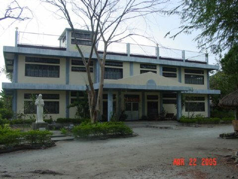 1.
Benedictine Retreat house – this retreat house is run by the Benedictine sisters
and was constructed on land donated by the Sebastian family. The late Sister
Henrietta Sebastian was a nun of the Benedictine order. A number of schools and
religious groups, even as far away from Manila, conduct their retreats in this
facility. The compound also houses relocated groups that were displaced by Mt.
Pinatubo. You can also buy religious articles from them (for pasalubongs). If
your group wants spiritual enlightenment, you may contact the Benedictine
sisters to arrange for a retreat. (Glenn Puzon). Click on the picture to
enlarge.
1.
Benedictine Retreat house – this retreat house is run by the Benedictine sisters
and was constructed on land donated by the Sebastian family. The late Sister
Henrietta Sebastian was a nun of the Benedictine order. A number of schools and
religious groups, even as far away from Manila, conduct their retreats in this
facility. The compound also houses relocated groups that were displaced by Mt.
Pinatubo. You can also buy religious articles from them (for pasalubongs). If
your group wants spiritual enlightenment, you may contact the Benedictine
sisters to arrange for a retreat. (Glenn Puzon). Click on the picture to
enlarge.